


The Jamestown Corporation calls its Comprehensive Plan a “road map.” But when you follow that map closely, it doesn’t just outline growth—it outlines a deliberate, decades-long strategy to acquire land, expand sovereignty, and shape the future of Clallam and Jefferson Counties. The question is no longer whether this is happening. It’s whether the public fully understands it—and whether anyone is asking where it ends.
The Plan Is Not New—It’s Been in Motion Since 1985
The Tribe’s Comprehensive Plan didn’t appear overnight. It began in 1985 and was formally updated in 2016. From the beginning, the objective has been clear:
Rebuild the Tribe’s land base and expand economic development.
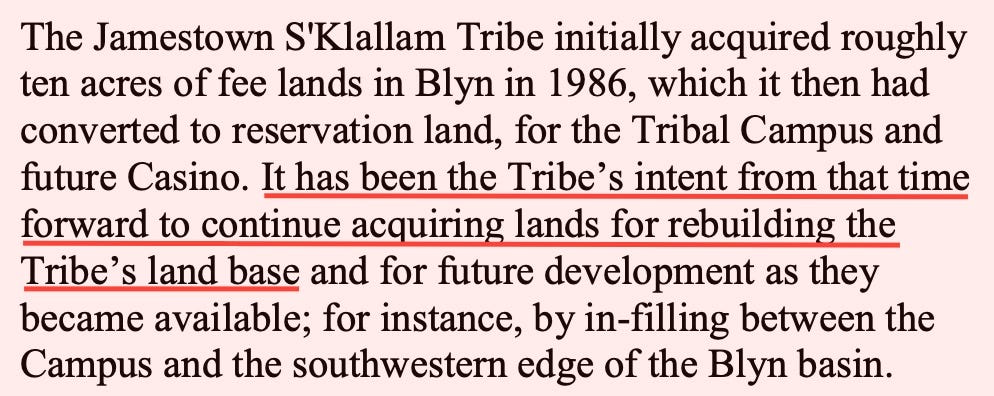
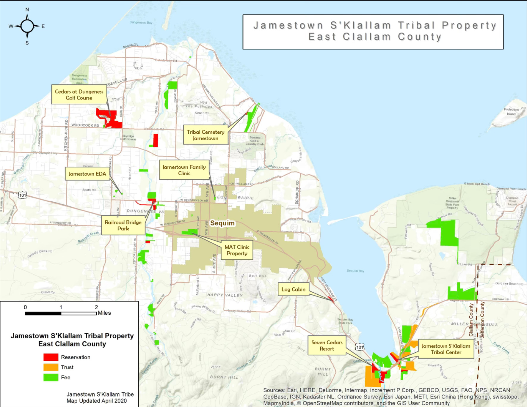
What started as roughly 10 acres in Blyn in 1986 has already grown into more than 1,700 acres.
And importantly, the plan explicitly states:
“At some time in the future, all of this property will likely be in reservation/trust status.”
That single sentence carries significant implications. Trust land is not subject to local or state jurisdiction—meaning zoning, taxation, and regulatory authority shift away from Clallam County and the State of Washington.
A 363-Square-Mile Target Area
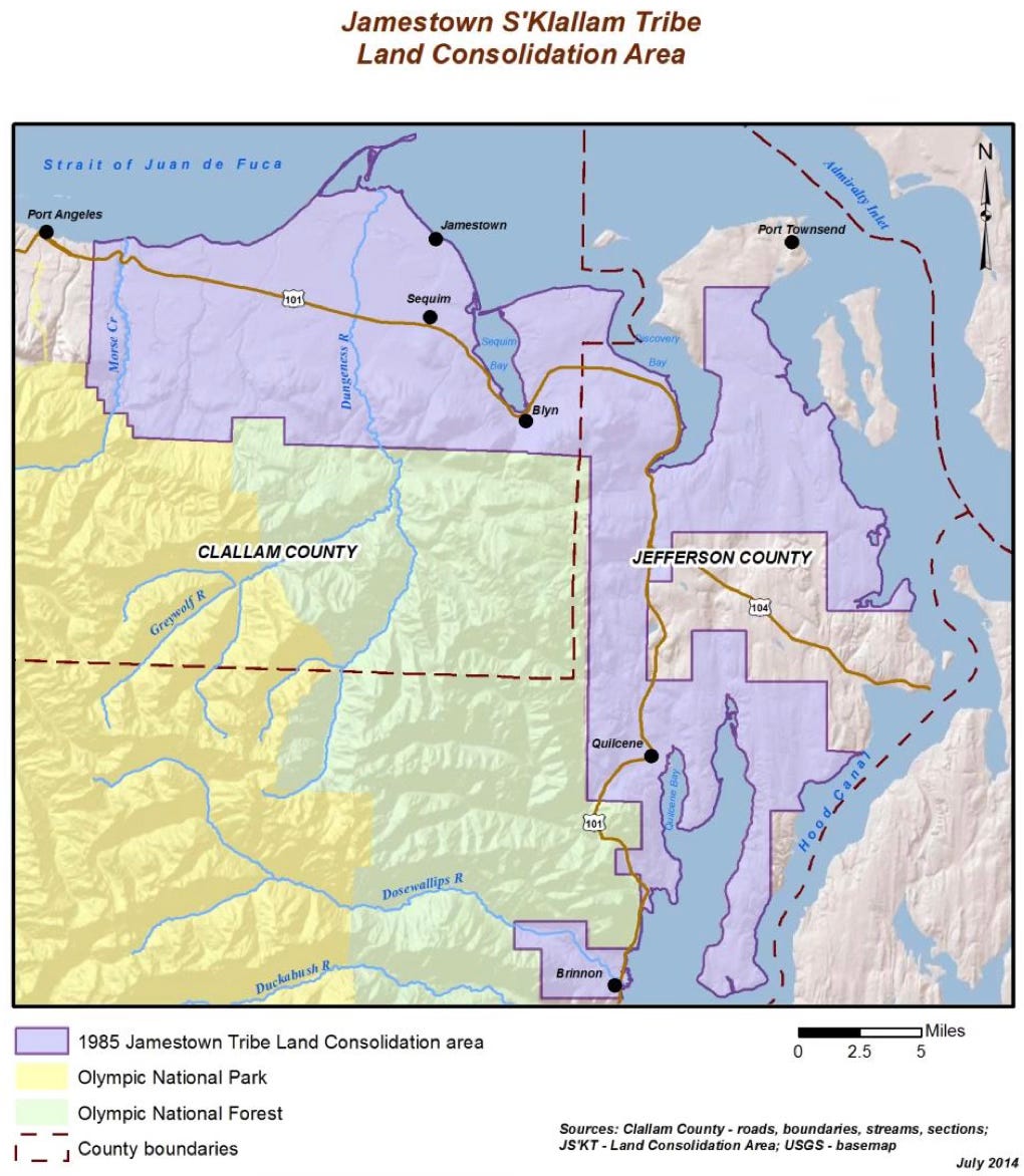
One of the most revealing elements of the plan is the Tribal Land Consolidation Area.
According to the Tribe’s own document:
Spans 32 miles east-to-west
Covers 36 miles north-to-south
Encompasses approximately 363 square miles
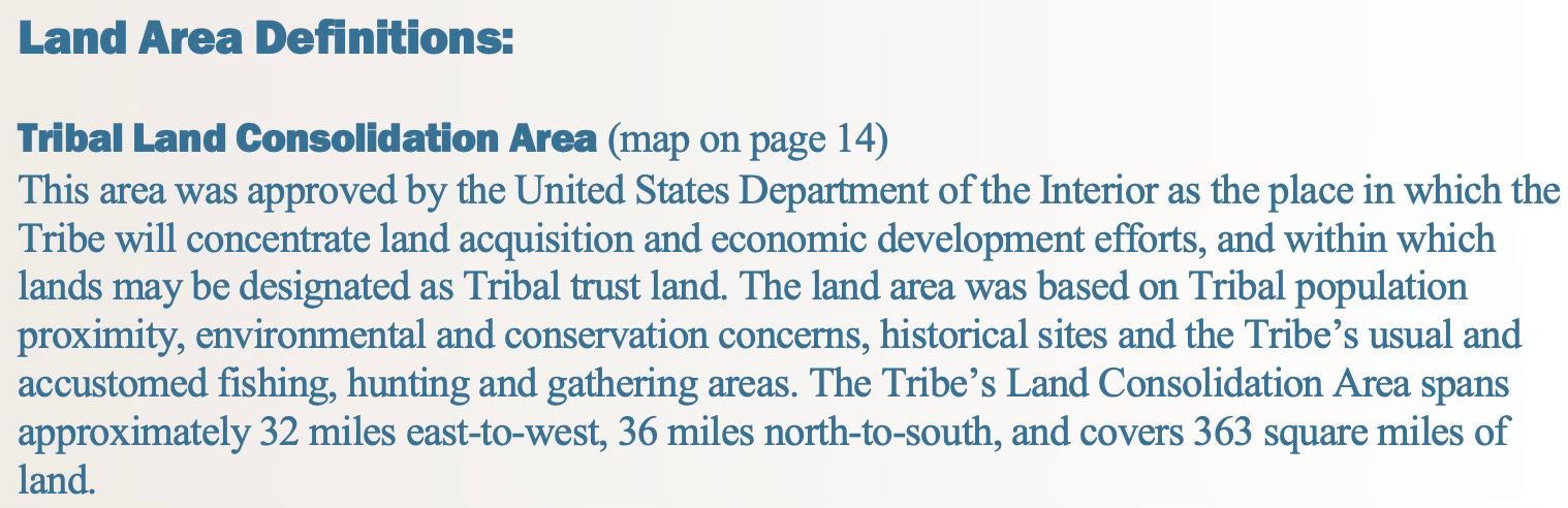
This is not a small footprint. It stretches across large portions of Clallam and Jefferson Counties, identifying where the Tribe intends to:
Acquire land
Develop economically
Convert properties into trust status
This is not opportunistic growth—it is geographically defined expansion.
“Reacquire Homelands”: Cultural Restoration or Strategic Expansion?
The plan frequently references:
“Reestablishing homelands”
“Reacquiring lands”
“Usual and accustomed areas” tied to the 1855 Point No Point Treaty
These phrases are grounded in history—but they are also being operationalized into modern land acquisition policy.
The Tribe’s defined “usual and accustomed” areas include:
Strait of Juan de Fuca
San Juan Islands
Admiralty Inlet
Hood Canal
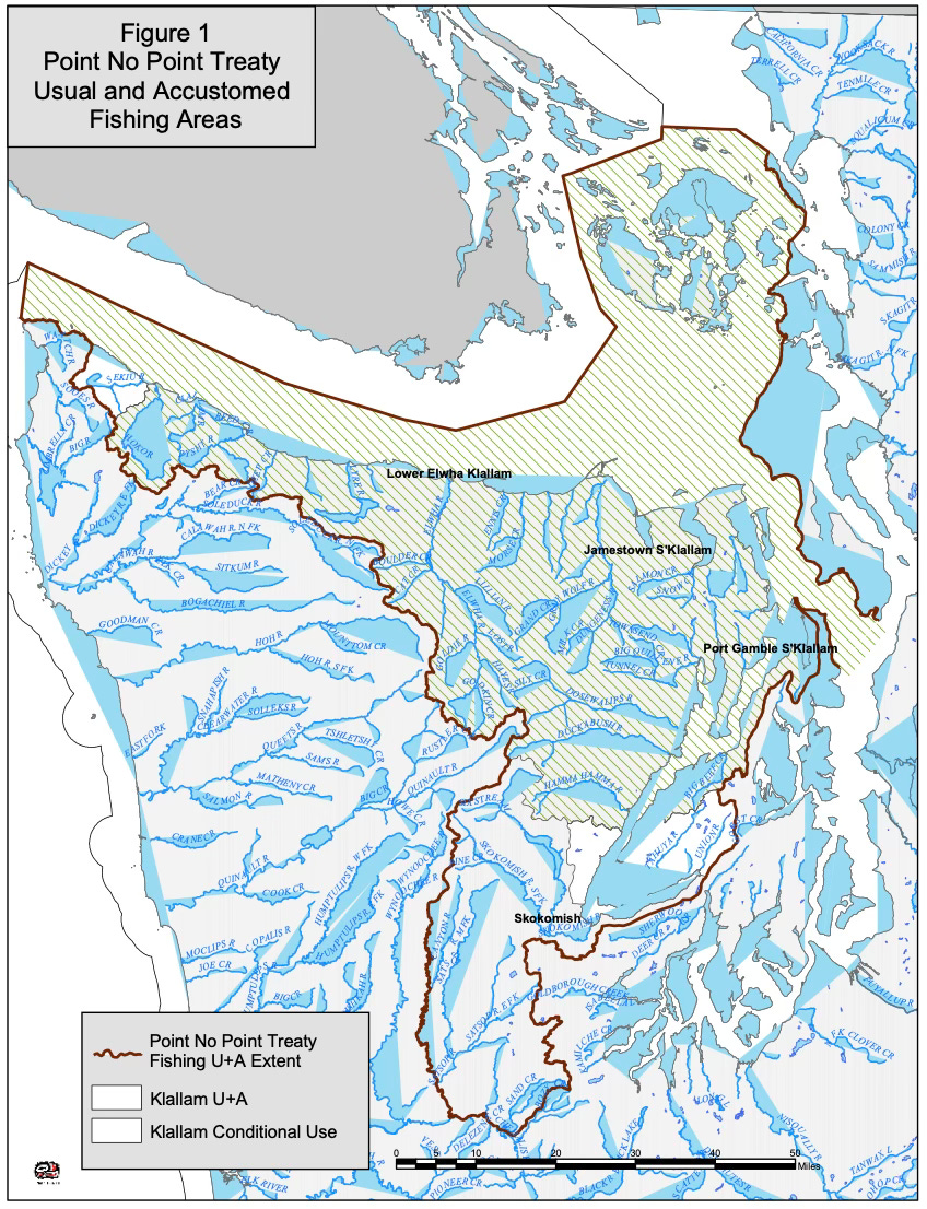
That’s not just symbolic geography—it’s tied to legal rights to fish, hunt, and gather, and increasingly, to influence over environmental and land-use policy.
Infrastructure That Follows Development—Or Leads It?
One of the more striking sections involves transportation:
“Safety improvements on [US Highway 101] should be timed with Tribal land development.”
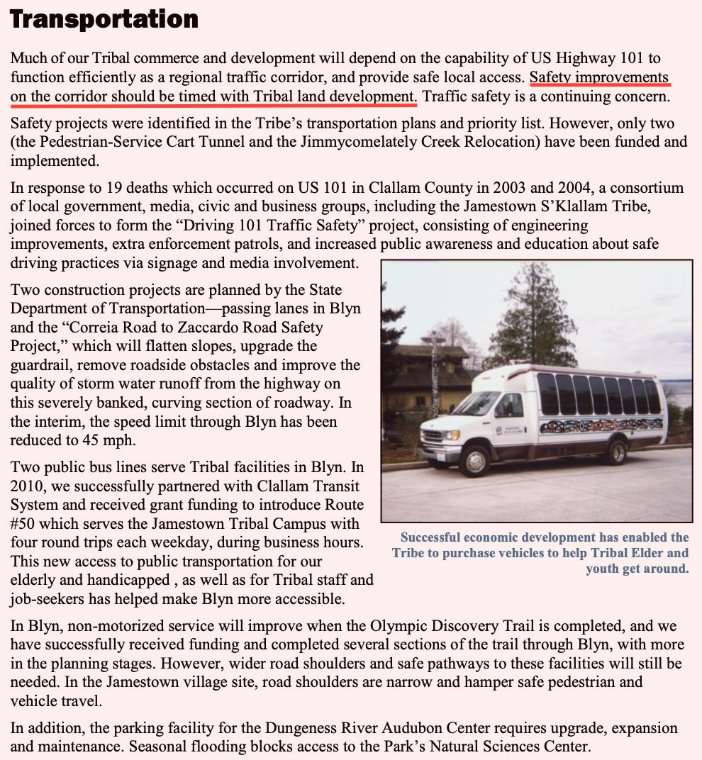
This raises a critical question for local residents:
Are infrastructure projects—like highway redesigns, access changes, or even roundabouts—being planned in coordination with Tribal development goals?
The plan confirms that:
The Tribe has already secured funding for infrastructure projects
Additional improvements are tied directly to future development
At a minimum, this suggests alignment between transportation planning and Tribal economic expansion. Whether that includes specific projects like Highway 101 roundabouts is not explicitly stated—but the framework for coordination is clearly there.
Economic Strategy: Competing as a Sovereign Entity
The Tribe identifies its “comparative advantages” as a sovereign nation and targets key industries:
Tourism
Healthcare and medical services
High-tech business
Marine services
Construction
This is not just community development—it is regional economic competition, with unique advantages:
Different regulatory environment
Access to federal funding streams
Ability to convert land into trust status
Ability to shelter businesses from taxes that competitors must pay
The plan openly acknowledges the need to:
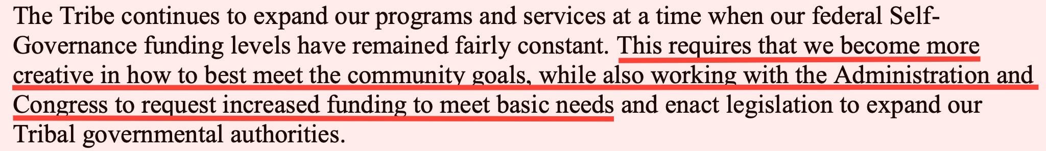
Expand governmental authority and request increased federal funding.
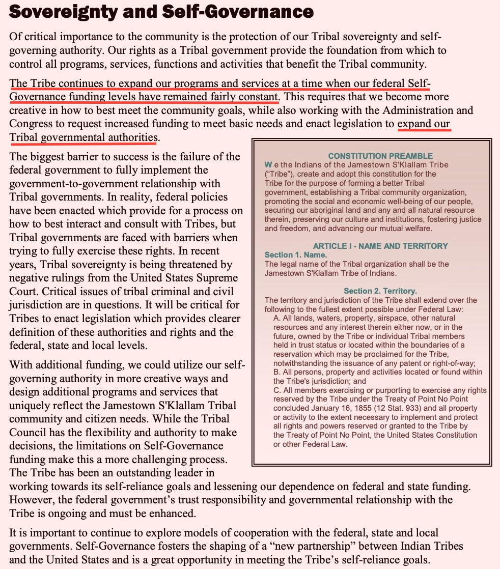
The Self-Sufficiency Paradox
Perhaps the most important—and least discussed—section is the Tribe’s stated goal of:
Self-sufficiency
Self-reliance
Reduced dependence on federal funding

At face value, that sounds reasonable.
But elsewhere, the plan states:
The Tribe will continue working with Congress to request increased funding.
So which is it?
A transition away from federal support?
Or an expansion of funding alongside an expansion of authority?
And more importantly:
When will that transition to “self-reliance” actually happen?
Accountability Without Access
The plan emphasizes measurable outcomes:
“Every Tribal program… should have some expected result… documented and compared with expected results.”
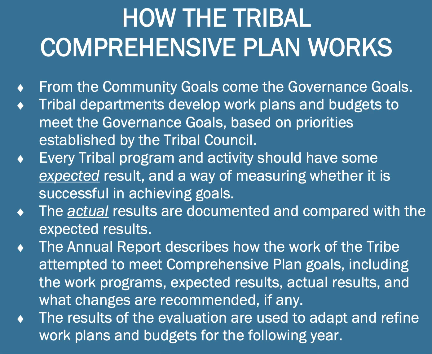
That sounds like accountability.
But for the general public:
These results are not readily accessible
Tribal governance operates outside many state transparency laws
Local residents have limited visibility into outcomes tied to regional impacts
So while the framework for accountability exists internally, external oversight is minimal to nonexistent.
The County’s Role: Acknowledged—but Limited
The plan makes an important admission:
“Decisions made by Clallam County or the State… will have an impact on our ability to utilize those lands.”
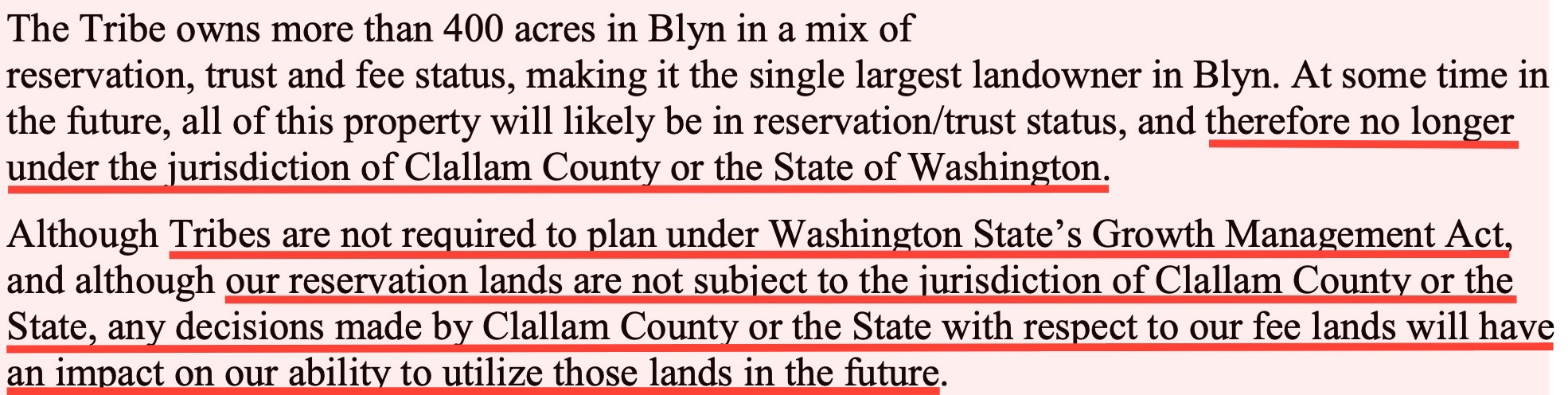
In other words, local policy still matters—for now.
But as land transitions into trust status, that influence diminishes.
A Bigger Question: Who Is This Plan For?
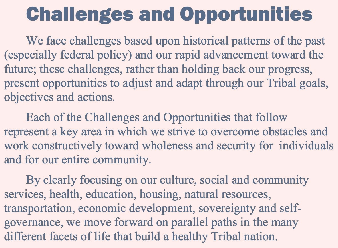
There’s no question the Comprehensive Plan is well-structured, strategic, and long-term in vision.
But it raises a fundamental issue:
Is this plan designed primarily for Tribal benefit and sovereignty expansion?
Or does it equally consider the long-term interests of the broader public living in the same region?
Because as land moves into trust status:
It exits local tax rolls
It leaves local regulatory control
It shifts governance away from elected county officials
And yet, its impacts—on infrastructure, housing, environment, and economy—remain shared.
Final Thought
The Jamestown S’Klallam Tribe has been clear:
“The Comprehensive Plan is the Tribe’s road map.”
The roadmap is not hidden. It’s public.
The real issue is whether local residents, elected officials, and policymakers are reading it closely—and asking the hard questions about where it leads.
Because once you understand the scope—363 square miles, long-term acquisition, and eventual trust conversion—this stops looking like incremental growth.
It starts looking like a generational strategy.
And strategies like that don’t unfold by accident.
Today’s Tidbit
The Jamestown Corporation is ramping up efforts to take control of the Dungeness and Protection Island National Wildlife Refuges, transferring them out of public ownership and into tribal control.
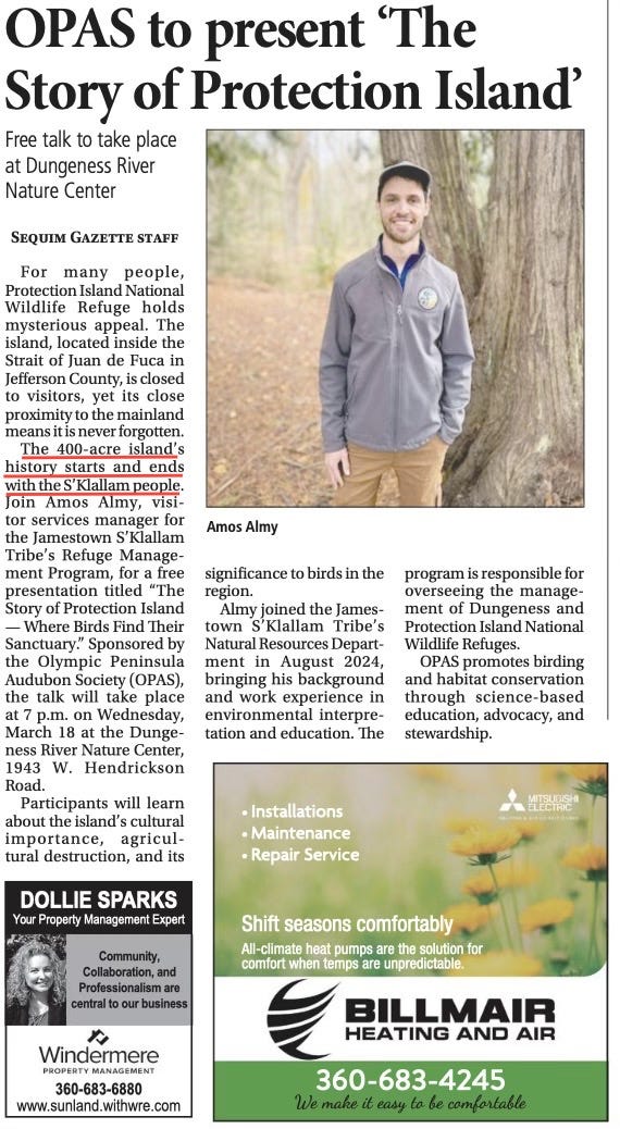
According to the Sequim Gazette, Protection Island’s history “starts and ends with the S’Klallam people.” That claim, however, overlooks documented history indicating the presence of the Chemakum Tribe prior to the S’Klallam.
Tribal officials say “appropriate public access” will continue. But that raises a simple question: Who decides what “appropriate” means? The same access? Reduced access? Conditional access?
Jamestown Corporation CEO Ron Allen framed the effort as transparent, noting outreach to city and county officials for letters of support. He also acknowledged public skepticism in a Sequim Gazette article yesterday:
“Some folks just don’t like Jamestown… People just don’t understand why the properties are important to us.”

But these lands are not just tribal history—they’ve been part of the American public trust for over a century, since designation under Woodrow Wilson.
According to Allen, the approximately 900 acres include historically significant areas, but they are also federally protected wildlife refuges. And potential future use raises additional concerns. Allen indicated that, if permitted, an oyster operation could be introduced—public records show the oysters will be a non-native species for commercial viability.
Meanwhile, a lawsuit remains pending between Protect the Peninsula’s Future and the Department of the Interior over aquaculture activity near the Dungeness refuge.
And there are still unresolved historical questions. Claims of permanent tribal settlements on the Dungeness Spit and Protection Island are debated, in part due to the lack of a reliable freshwater source. However, the area on the Spit is tied to the historical Dungeness Massacre, where the Jamestown Tribe slaughtered 17 Tsimshian Indians who were resting during a long canoe journey.
All of this leads to a larger issue:
This isn’t just about history.
It’s about control—of land, access, and future use.
And once public land is transferred out of the public domain, there’s no easy way to get it back.
