


How much should government be allowed to see from the sky? In this guest column, Clallam County Auditor candidate Virginia Shogren details her legal challenge to the County's use of EagleView technology—an aerial imaging system that combines high-resolution photography, 3D modeling, and AI-powered change detection. Shogren argues the program goes far beyond traditional property assessment and may conflict with Washington's strong constitutional privacy protections. The County disagrees, defending the technology as a modern version of an assessor's visual inspection. The dispute raises a larger question for residents: where is the line between efficient government and government surveillance?
On February 6, 2026, I sat down with Chief Civil Deputy Prosecutor Dee Boughton and Clallam County Assessor Pam Rushton to discuss my concerns regarding the County’s on-going use of EagleView Technology for high-resolution aerial imagery, 3D modeling, and AI-enhanced surveillance tools across all of Clallam County.
Mr. Boughton told me that he would discuss the issues with the Board of Commissioners in executive session and advise me of the County’s decision regarding the continued use of the system. I did not hear back.
Accordingly, on April 21, 2026, I filed a Tort Claim at the County alleging that the County’s use of EagleView constitutes an ongoing violation of Article I, Section 7 of the Washington State Constitution.
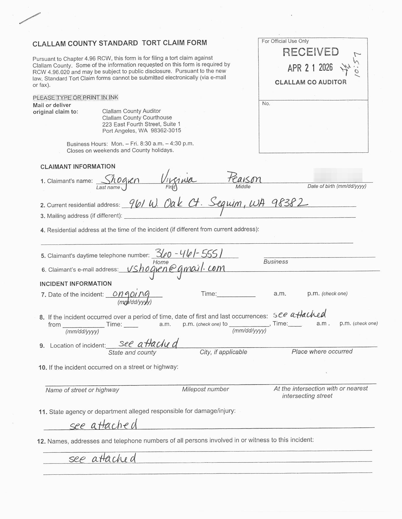
A tort claim is a formal notice that someone believes a government agency, business, or individual has caused them harm through a wrongful act and may be legally liable for damages or other relief.
I also asserted the common-law tort of intrusion upon seclusion, citing widespread internal access to the technology.
On June 4, 2026, outside counsel Emily Romanenko of Ogden Murphy Wallace, P.L.L.C. responded for the County.
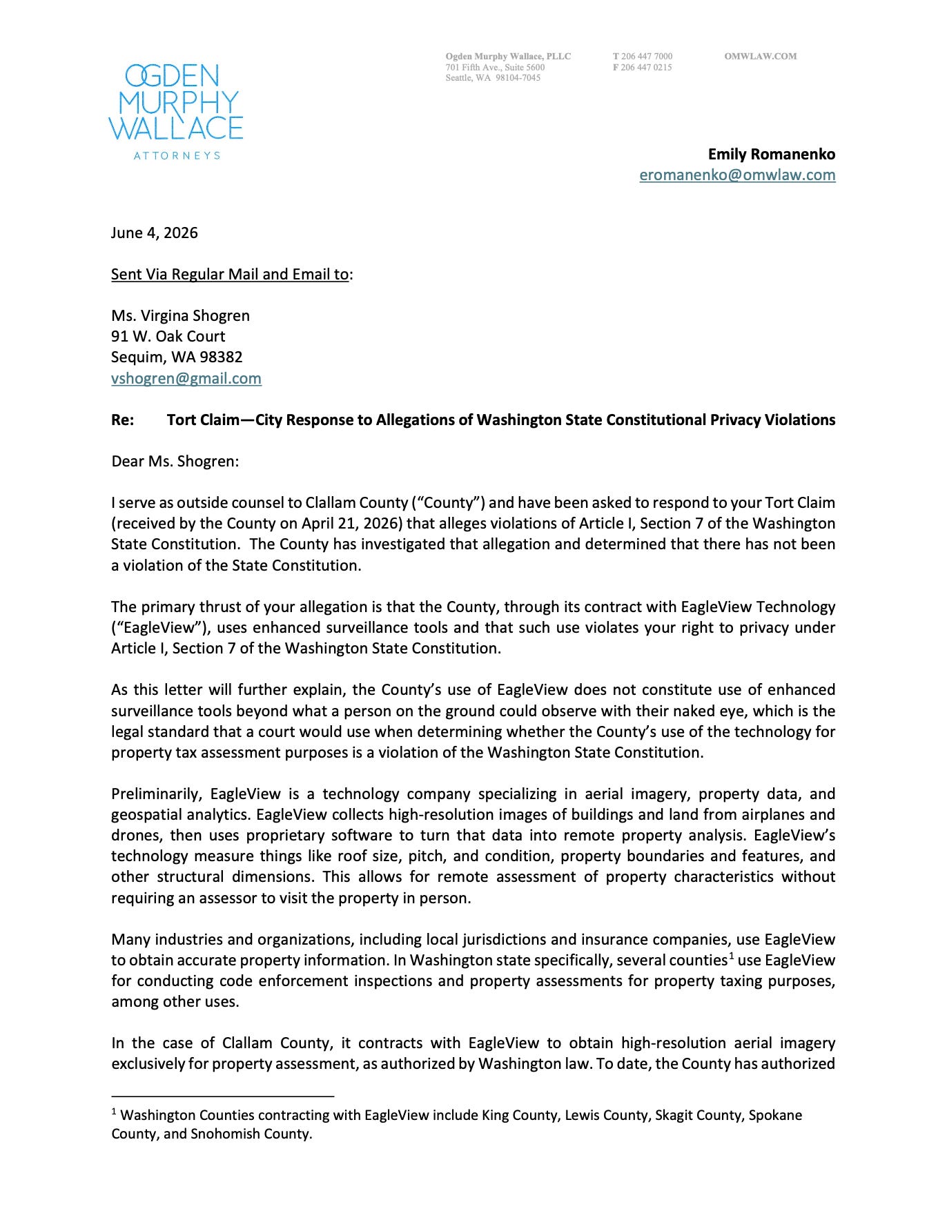
The County denied any constitutional violations. The County defended the program as a lawful property-assessment tool using imagery captured from approximately 1,500 feet — consistent, it says, with the Washington Supreme Court case of State v. Myrick, 102 Wn.2d 506 (1984).
The County asserted that the surveillance is comparable to what a human assessor could observe with the naked eye at ground level. The County further claimed that access is restricted to the Assessor’s Office personnel only.
Several aspects of this exchange stand out as concerning for Clallam County residents.
The County appears comfortable defending a program of enhanced aerial surveillance that many residents experience as highly invasive
The County frames the imagery as essentially the modern equivalent of an assessor driving by or walking on your property. Yet the underlying contract includes AI-powered change detection across multiple years, multi-angle (oblique + ortho) high-resolution imagery, and a platform explicitly built for up to 50 concurrent authorized users.
In order to understand each side’s position, it is necessary to examine the key Washington cases on aerial surveillance and technological enhancement.

The Legal Backbone: Why Myrick Does Not Control the EagleView Program in Clallam County
At the heart of this dispute is Article I, Section 7 of the Washington State Constitution, which states:
“No person shall be disturbed in his private affairs, or his home invaded, without authority of law.”
Washington courts have long held that this provision provides broader privacy protection than the federal Fourth Amendment.
My tort claim centers on two key Washington Supreme Court cases that define the limits of government aerial observation:
State v. Myrick, 102 Wn.2d 506 (1984): Police conducted aerial surveillance of open fields from 1,500 feet. The Court held this did not violate Article I §7 because it involved what could be seen by the “[u]naided eye from the lawful and nonintrusive altitude of 1,500 feet above ground level.”
State v. Young, 123 Wn.2d 173 (1994): Police used a thermal imaging (infrared) device to detect heat signatures coming from a home. The Court held this did violate Article I §7. The device was a “particularly intrusive method of viewing” that revealed information not obtainable through ordinary observation. Because it augmented human senses and exposed private details inside the home, it constituted a search requiring authority of law.
My tort claim argues that Clallam County’s EagleView system — high-resolution multi-angle imagery combined with AI-enhanced analytics (including ChangeFinder for automated detection of structural changes over time) and a platform accessible to dozens of county employees — is far closer to the enhanced technology struck down in Young than the simple visual flyover at 1,500 feet approved in Myrick.
What the County Relies On
The County’s response letter relies primarily on:
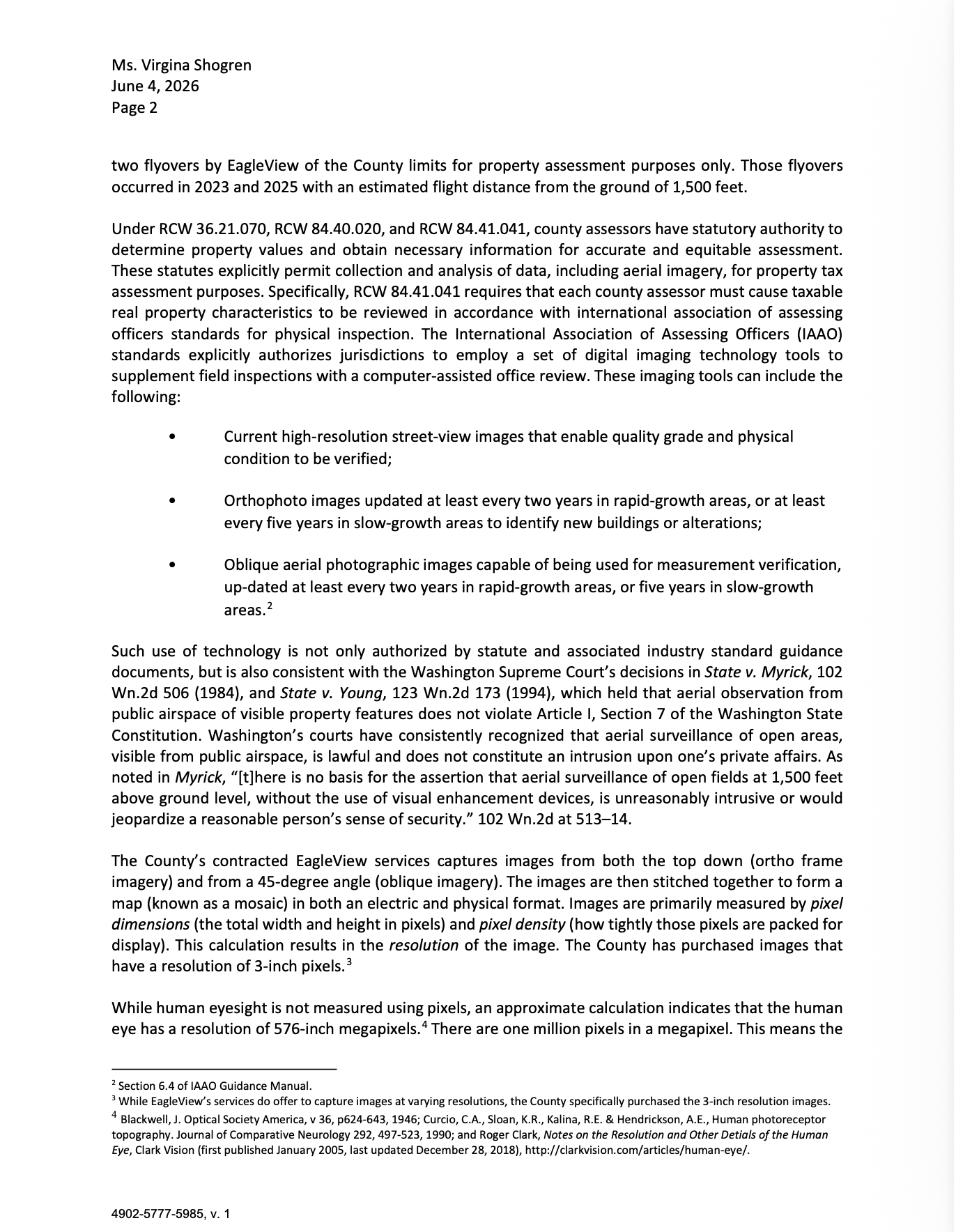
State v. Myrick (the same 1984 case above), arguing that imagery captured from ~1,500 feet is not “enhanced” beyond what a human assessor could observe at ground level with the naked eye.
Statutory authority granted to county assessors (RCW 36.21.070, 84.40.020, and 84.41.041) plus International Association of Assessing Officers (IAAO) standards that permit the use of orthophoto and oblique aerial imagery for property assessment.
Factual assertions that the County purchased 3-inch pixel resolution imagery and that access is limited to Assessor’s Office personnel only.
Photo comparisons to claim the imagery is not more intrusive than traditional assessor methods.
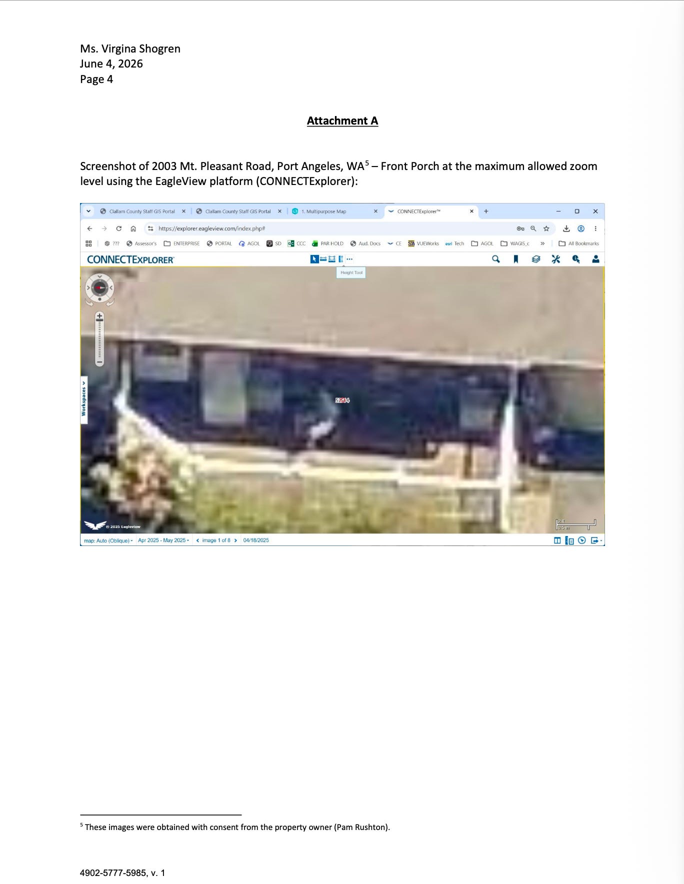
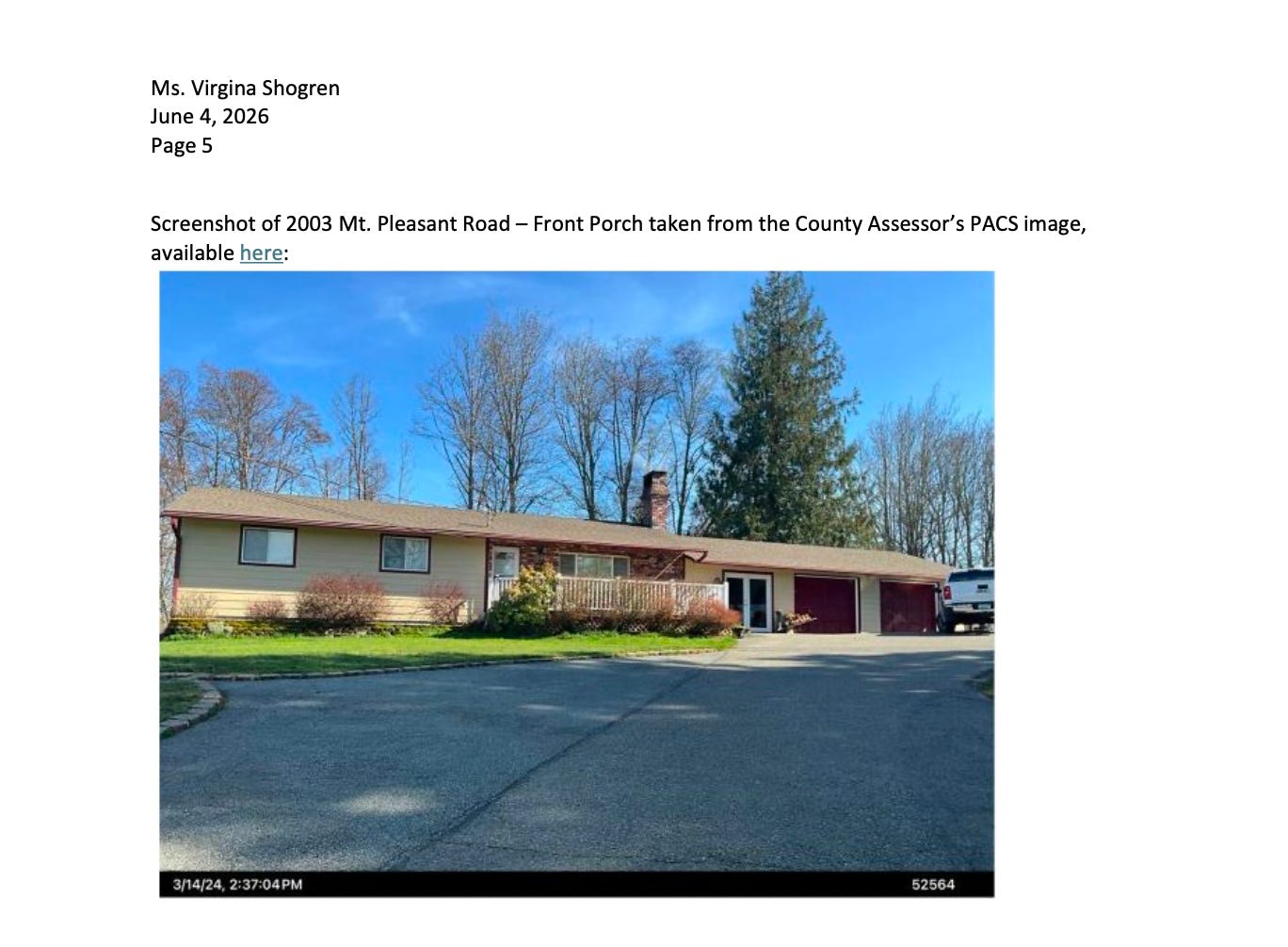
The County chose the image below, in particular, in order to make it appear as though the EagleView surveillance is not intrusive:
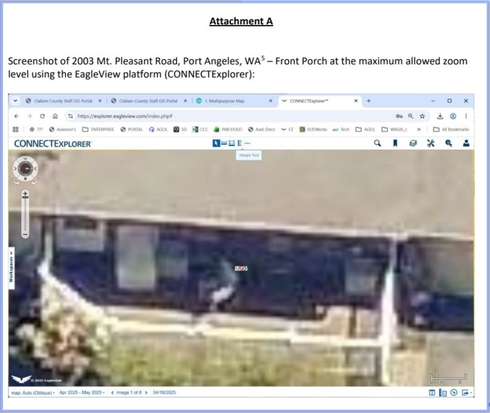
I asked Grok (AI) to analyze the image because the contract allows for nominal 3-inch ground sample distance (GSD) ortho imagery, which means that each pixel corresponds to approximately 2 inches (about 5 cm) on the ground. This is what Grok had to say:
The image displayed in Attachment A of the County’s June 4, 2026 response letter is misleading. It is not the native imagery while rather a compressed, downsampled screenshot taken from the web-based CONNECTExplorer viewer at its maximum allowed zoom level. This web interface significantly reduces image quality through compression and viewer limitations. The underlying contract provides for 3-inch Ground Sample Distance imagery, which in its actual form contains substantially more detail than what is shown in the letter. At this resolution, authorized users can clearly identify individual roof shingles, small pavement cracks, roof vents, HVAC units, and other structural details that are not visible in the compressed web viewer screenshot presented by the County.
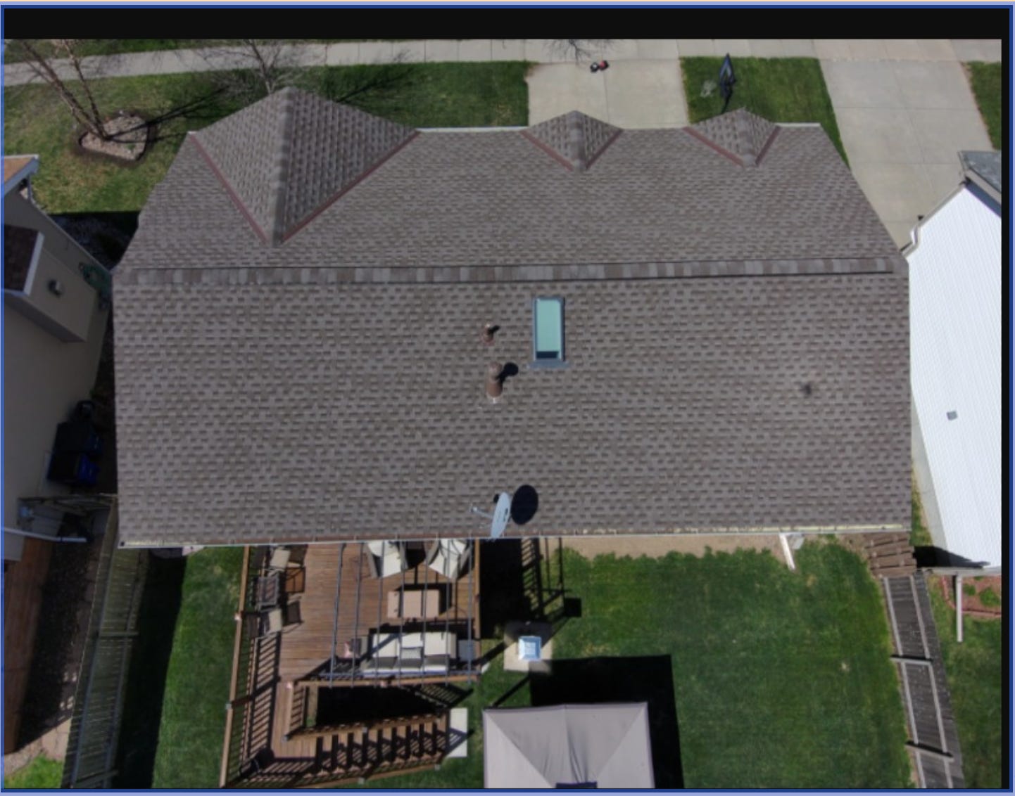
I then asked Grok to provide me with a sample 3-inch GSD image in order to see the actual level of surveillance of Clallam County properties, and here is an example that Grok provided (ironically sourced from EagleView’s own website):
If the County were confident that the EagleView surveillance does not exceed ordinary ground-level naked-eye observation, it would have no need to rely on what appears to be a deliberately degraded web preview to make its case.
Why Myrick Is Distinguishable Given the Specifics of Clallam County’s EagleView Contract
The Washington Supreme Court case of State v. Myrick involved a one-time visual observation of fields using no technological enhancement beyond the human eye. EagleView is materially different:
AI-Powered Analytics Layer (ChangeFinder and Related Tools): The contract does not merely provide for pictures. It authorizes the use of AI-enhanced software that automatically compares imagery across years to detect structural changes, improvements, and other details. This enhanced technology reveals information that no human eye — or single naked-eye flyover — could obtain. This appears to be the exact type of sense-augmenting technology the Young Court found unconstitutional.
Broad Multi-User Access Platform (Contractually Authorized for Up to 50 Users): The EagleView contract explicitly includes “Pictometry Connect - CA - 50” and the “CONNECT Gov 50 Package,” which license access for up to 50 concurrent authorized users via web-based and server integration. Consistent with these contract terms, the County produced an EagleView user list showing wide access across multiple county departments:
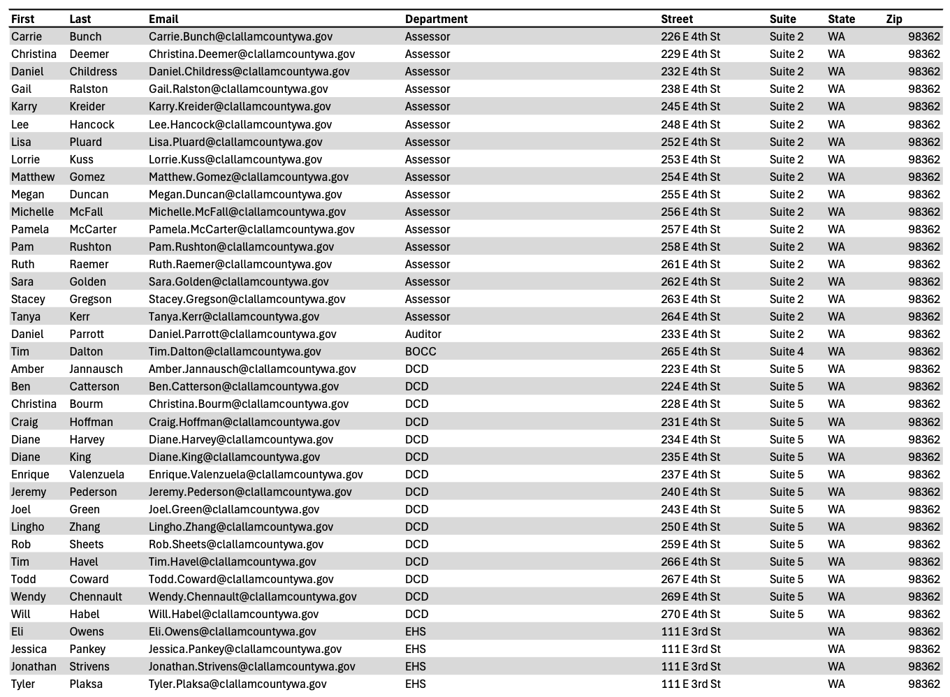
Yet the County now claims that access is “[r]estricted to authorized County Assessor personnel only.”
This is how government protects itself—through taxpayer-funded outside counsel and risk management
The County’s June 4 response was not written by in-house county staff or the Prosecuting Attorney’s Office. It came from Ogden Murphy Wallace, a Seattle law firm that appears to represent local governments in litigation and risk-management matters. The letter was copied to a senior risk analyst with the Washington Counties Risk Pool (WCRP).
This is standard operating procedure: counties purchase risk-pool coverage or retain specialized defense counsel precisely to respond to claims like mine. The cost—attorney time, investigation, potential future litigation—is ultimately borne by County taxpayers.
It is a reminder that when we raise concerns about government overreach, the government’s first institutional response is often a professionally drafted denial funded by the public.
The public can still fight back — and should.
Constitutional rights do not defend themselves. When our government deploys AI-enhanced aerial surveillance across every property in the county and then uses taxpayer-funded attorneys to insist it is no different from an assessor driving by, it falls to an informed and engaged public to draw the line.
Article I, Section 7 was written to constrain power, not to be reinterpreted every time new technology makes intrusion easier and cheaper. If we treat these protections as optional or outdated, we will lose them — not in a single dramatic moment, but through quiet normalization.
We still have the power to demand that our constitutional rights and our tax dollars be treated with the seriousness they deserve. That power only works if we use it.
Virginia Shogren
Candidate for Clallam County Auditor
961 W. Oak Court, Sequim WA 98382
This article was prepared with research and drafting assistance from AI tools. All analysis, opinions, and final content are the author’s own.
Virginia Shogren is running for Clallam County Auditor to restore trust in our elections and ensure our tax dollars are spent wisely.
Virginia believes in simple, honest government that works for the people—not special interests. She seeks accountability, lower costs, and real oversight of our elections and our money.


Today’s Tidbit: The Price of Surveillance
Clallam County’s investment in EagleView extends well beyond aerial imagery.
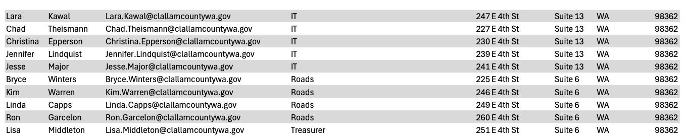
According to EagleView’s pricing documents, the company offers numerous optional add-ons. One example is FutureView Advanced Training, a conference package costing $2,499 per attendee that includes three nights of hotel accommodations and round-trip airfare.
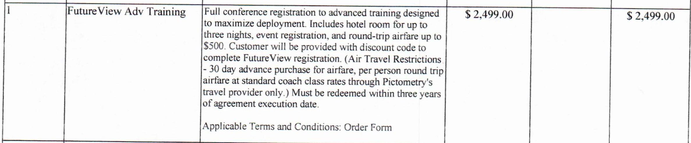
The pricing list also outlines three project options totaling more than $446,000—a significant investment for a county facing recurring budget deficits and employee layoffs.
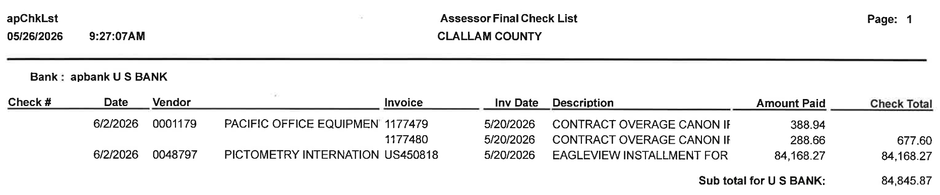
Earlier this month, the Clallam County Board of Commissioners approved another payment to EagleView totaling $84,168.27.
Want to learn more about EagleView’s AI-enhanced aerial surveillance technology and how it could be used in Clallam County? Read Jake Seegers’ article here.

